Choose Which Site You Want To See


Explorer Ol 20 South Devon Map: Take in the southern part of Dartmoor National Park and the southern region of Devon with the Explorer OL 20 Map from Ordnance Survey, a detailed guide to this spectacular area. The west side covers Plymouth, Ivybridge and the pleasant village of Newton Ferrers on the River Yealm esturary while the east side takes in Torquay, Dartmouth and Brixham.
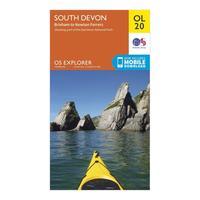
Ordnance Survey Explorer Ol 20 South Devon Map, Orange: Take in the southern part of Dartmoor National Park and the southern region of Devon with the Explorer OL 20 Map from Ordnance Survey, a detailed guide to this spectacular area. The west side covers Plymouth, Ivybridge and the pleasant village of Newton Ferrers on the River Yealm esturary while the east side takes in Torquay, Dartmouth and Brixham. Colour Swatch:OrangeBrand:ORDNANCE SURVEYColour:Orange
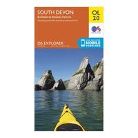
Ordnance Survey Explorer Ol 20 South Devon Map, Orange: Take in the southern part of Dartmoor National Park and the southern region of Devon with the Explorer OL 20 Map from Ordnance Survey, a detailed guide to this spectacular area. The west side covers Plymouth, Ivybridge and the pleasant village of Newton Ferrers on the River Yealm esturary while the east side takes in Torquay, Dartmouth and Brixham. Colour Swatch:OrangeBrand:ORDNANCE SURVEYColour:Orange
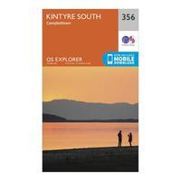
Ordnance Survey Explorer 256 Kintyre South Campeltown Map With Digital Version, Orange: The essential map for outdoor activities in Kintyre South Campeltown. The OS Explorer Map is the Ordnance Survey\'s most detailed folding map and is recommended for anyone enjoying outdoor activities including walking, horse riding and off-road cycling. This map now comes with a digital version which you can download to your smartphone or tablet. Providing complete GB coverage, the OS Explorer map series details information essential in the great outdoors, including youth hostels, pubs and...

Ordnance Survey Explorer Active 455 South Harris Map With Digital Version, Orange: The essential map for outdoor activities in all weathers in South Harris. The OS Explorer Active Map is the Ordnance Survey\'s most detailed folding map and is recommended for anyone enjoying outdoor activities including walking, horse riding and off-road cycling. This map now comes with a digital version which you can download to your smartphone or tablet. Providing complete GB coverage, the OS Explorer map series details information essential in the great outdoors, including youth hostels,...

Ordnance Survey Explorer 453 Benbecula & South Uist Map With Digital Version, Orange: The essential map for outdoor activities in Benbecula and South Uist. The OS Explorer Map is the Ordnance Survey\'s most detailed folding map and is recommended for anyone enjoying outdoor activities including walking, horse riding and off-road cycling. This map now comes with a digital version which you can download to your smartphone or tablet. Providing complete GB coverage, the OS Explorer map series details information essential in the great outdoors, including youth hostels, pubs and...

Ordnance Survey Explorer Active 455 South Harris Map With Digital Version, Orange: The essential map for outdoor activities in all weathers in South Harris. The OS Explorer Active Map is the Ordnance Survey\'s most detailed folding map and is recommended for anyone enjoying outdoor activities including walking, horse riding and off-road cycling. This map now comes with a digital version which you can download to your smartphone or tablet. Providing complete GB coverage, the OS Explorer map series details information essential in the great outdoors, including youth hostels,...

Ordnance Survey Explorer 453 Benbecula & South Uist Map With Digital Version, Orange: The essential map for outdoor activities in Benbecula and South Uist. The OS Explorer Map is the Ordnance Survey\'s most detailed folding map and is recommended for anyone enjoying outdoor activities including walking, horse riding and off-road cycling. This map now comes with a digital version which you can download to your smartphone or tablet. Providing complete GB coverage, the OS Explorer map series details information essential in the great outdoors, including youth hostels, pubs and...

Ordnance Survey Explorer 256 Kintyre South Campeltown Map With Digital Version, Orange: The essential map for outdoor activities in Kintyre South Campeltown. The OS Explorer Map is the Ordnance Survey\'s most detailed folding map and is recommended for anyone enjoying outdoor activities including walking, horse riding and off-road cycling. This map now comes with a digital version which you can download to your smartphone or tablet. Providing complete GB coverage, the OS Explorer map series details information essential in the great outdoors, including youth hostels, pubs and...

Explorer 453 Benbecula & South Uist Map With Digital Version: The essential map for outdoor activities in Benbecula and South Uist. The OS Explorer Map is the Ordnance Surveyâs most detailed folding map and is recommended for anyone enjoying outdoor activities including walking, horse riding and off-road cycling. This map now comes with a digital version which you can download to your smartphone or tablet.

Explorer 256 Kintyre South Campeltown Map With Digital Version: The essential map for outdoor activities in Kintyre South Campeltown. The OS Explorer Map is the Ordnance Surveyâs most detailed folding map and is recommended for anyone enjoying outdoor activities including walking, horse riding and off-road cycling. This map now comes with a digital version which you can download to your smartphone or tablet.

Explorer Active 455 South Harris Map With Digital Version: The essential map for outdoor activities in all weathers in South Harris. The OS Explorer Active Map is the Ordnance Surveyâs most detailed folding map and is recommended for anyone enjoying outdoor activities including walking, horse riding and off-road cycling. This map now comes with a digital version which you can download to your smartphone or tablet.

Explorer Ol 21 South Pennines Map: Discover the beauty of the South Pennines with the Explorer OL21, a detailed map from Ordnance Survey which allows you to explore the Pennines in all its glory. This essential map covers Burnley, Hebdem Bridge, Todmorden and Keighley.

Explorer Ol 36 South Pembrokeshire Map: Your essential guide to South Pembrokeshire on the west coast of Wales, the Explorer OL 36 from Ordnance Survey is a detailed map which allows you to navigate your way along the length of The Pembrokeshire Coast National Path or the Knightsâ Way near Narberth. A popular area for surfers, swimmers and walkers, South Pembrokeshire is brimming with quaint seaside towns and fantastic sights on and off the tourist route.
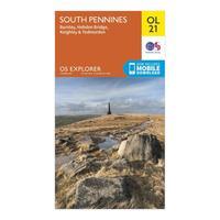
Ordnance Survey Explorer Ol 21 South Pennines Map, Orange: Discover the beauty of the South Pennines with the Explorer OL21, a detailed map from Ordnance Survey which allows you to explore the Pennines in all its glory. This essential map covers Burnley, Hebdem Bridge, Todmorden and Keighley. Colour Swatch:OrangeBrand:ORDNANCE SURVEYColour:Orange
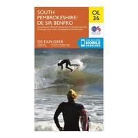
Ordnance Survey Explorer Ol 36 South Pembrokeshire Map, Orange: Your essential guide to South Pembrokeshire on the west coast of Wales, the Explorer OL 36 from Ordnance Survey is a detailed map which allows you to navigate your way along the length of The Pembrokeshire Coast National Path or the Knights\' Way near Narberth. A popular area for surfers, swimmers and walkers, South Pembrokeshire is brimming with quaint seaside towns and fantastic sights on and off the tourist route. Colour Swatch:OrangeBrand:ORDNANCE SURVEYColour:Orange
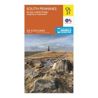
Ordnance Survey Explorer Ol 21 South Pennines Map, Orange: Discover the beauty of the South Pennines with the Explorer OL21, a detailed map from Ordnance Survey which allows you to explore the Pennines in all its glory. This essential map covers Burnley, Hebdem Bridge, Todmorden and Keighley. Colour Swatch:OrangeBrand:ORDNANCE SURVEYColour:Orange
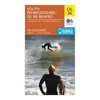
Ordnance Survey Explorer Ol 36 South Pembrokeshire Map, Orange: Your essential guide to South Pembrokeshire on the west coast of Wales, the Explorer OL 36 from Ordnance Survey is a detailed map which allows you to navigate your way along the length of The Pembrokeshire Coast National Path or the Knights\' Way near Narberth. A popular area for surfers, swimmers and walkers, South Pembrokeshire is brimming with quaint seaside towns and fantastic sights on and off the tourist route. Colour Swatch:OrangeBrand:ORDNANCE SURVEYColour:Orange

Explorer English Lakes South West Map: This Ordnance Survey Map of the Lake District South West region is perfect for exploring the Lakes including Scafell Pike and Coniston

Explorer English Lakes South East Map: This Ordnance Survey Map covers OL7 the south east part of the Lake District which leads you through some impressive lakeside areas around beautiful Windermere and dramatic mountains