Choose Which Site You Want To See


Explorer Ol 43 Hadrianâs Wall Map: Discover over 2000 years of history and walk in the footsteps of the Romans with the Explorer OL 43, a detailed Ordnance Survey map which takes in a large section of Hadrianâs Wall and some of the most dramatic country in England. Points of great interest along this route include Corbridge, Hexham, Haydon Bridge, Houseteads, Chesters Roman Fort and Vindolanda.

Ordnance Survey Explorer Ol 43 Hadrian\'s Wall Map, Orange: Discover over 2000 years of history and walk in the footsteps of the Romans with the Explorer OL 43, a detailed Ordnance Survey map which takes in a large section of Hadrian\'s Wall and some of the most dramatic country in England. Points of great interest along this route include Corbridge, Hexham, Haydon Bridge, Houseteads, Chesters Roman Fort and Vindolanda. Colour Swatch:OrangeBrand:ORDNANCE SURVEYColour:Orange

Ordnance Survey Explorer Ol 43 Hadrian\'s Wall Map, Orange: Discover over 2000 years of history and walk in the footsteps of the Romans with the Explorer OL 43, a detailed Ordnance Survey map which takes in a large section of Hadrian\'s Wall and some of the most dramatic country in England. Points of great interest along this route include Corbridge, Hexham, Haydon Bridge, Houseteads, Chesters Roman Fort and Vindolanda. Colour Swatch:OrangeBrand:ORDNANCE SURVEYColour:Orange

Explorer Active Ol 43 Hadrian\'s Wall Map: The essential map for outdoor activities in all weathers in Hadrian\'s Wall. The OS Explorer Active Map is the Ordnance Surveyâs most detailed folding map and is recommended for anyone enjoying outdoor activities including walking, horse riding and off-road cycling. This map now comes with a digital version which you can download to your smartphone or tablet.

Ordnance Survey Explorer Active Ol 43 Hadrian\'s Wall Map, Orange: The essential map for outdoor activities in all weathers in Hadrian\'s Wall. The OS Explorer Active Map is the Ordnance Survey\'s most detailed folding map and is recommended for anyone enjoying outdoor activities including walking, horse riding and off-road cycling. This map now comes with a digital version which you can download to your smartphone or tablet. Colour Swatch:OrangeBrand:ORDNANCE SURVEYColour:Orange

Ordnance Survey Explorer Active Ol 43 Hadrian\'s Wall Map, Orange: The essential map for outdoor activities in all weathers in Hadrian\'s Wall. The OS Explorer Active Map is the Ordnance Survey\'s most detailed folding map and is recommended for anyone enjoying outdoor activities including walking, horse riding and off-road cycling. This map now comes with a digital version which you can download to your smartphone or tablet. Colour Swatch:OrangeBrand:ORDNANCE SURVEYColour:Orange

Hadrian\'s Wall - Os Explorer Map Sheet Number Ol43: Purchase the Hadrian\'s Wall folded map: double-sided (boarded cover) from the OS Explorer Map range

Hadrian\'s Wall - Os Explorer Active Map Sheet Number Ol43: Purchase the Hadrian\'s Wall folded map: double-sided (boarded cover) from the OS Explorer Map range

The Romans And Hadrian\'s Wall Day Tour From Windermere: Follow the wall along segments of this UNESCO World Heritage Site. The Hadrian?s Wall tour travels out of the Lake District for the day and up towards the Scottish Borders. The main focus of the day is the ?Wall? of which you travel along the many ?Mile Castles? and ?Towers?. During your day you will have time to enjoy the Roman Army Museum, exploring the history of the Romans and learning what it was like to work on the ?Wall?.

The Romans And Hadrian\'s Wall Day Tour From Windermere: Follow the along segments of this UNESCO World Heritage Site. The 8.5-hour Hadrian?s Wall tour travels out of the Lake District and up toward the Scottish Borders. The main focus of the day is the ?wall? of which you travel along the many ?mile castles? and ?towers?. During your day you will have time to enjoy the Roman Army Museum and Vindolanda, giving you the chance to explore the history of the Romans and learning what it was like to work on \'the wall?.
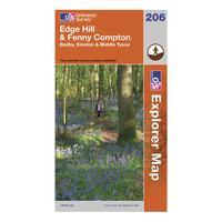
Ordnance Survey Explorer 206 Edge Hill & Fenny Compton Map, Assorted: Part of Ordnance Survey\'s impressive Explorer series, the 206 Explorer Map allows you explore the northern section of the Cotswolds, an area known well for its outstanding natural beauty. This spectacular area can be seen by walking the Centenary Way through Middle Tysoe and Edge Hill up to Fenny Compton. Colour Swatch:AssortedAdditional Notes:With the 1:25000 scale Ordnance Survey Explorer 206 Edge Hill & Fenny Compton Map you are sure to find all the best walks, routes and places of interest...
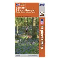
Ordnance Survey Explorer 206 Edge Hill & Fenny Compton Map, Assorted: Part of Ordnance Survey\'s impressive Explorer series, the 206 Explorer Map allows you explore the northern section of the Cotswolds, an area known well for its outstanding natural beauty. This spectacular area can be seen by walking the Centenary Way through Middle Tysoe and Edge Hill up to Fenny Compton. Colour Swatch:AssortedAdditional Notes:With the 1:25000 scale Ordnance Survey Explorer 206 Edge Hill & Fenny Compton Map you are sure to find all the best walks, routes and places of interest...

Hadrian\'s Wall Eagle Tour For Up To Three People: Enjoy fantastic aerial views as you take to the skies over the beautiful 2000 year old World Heritage site â Hadrianâs Wall. After running through a quick safety presentation from your pilot, youâll take off from Carlisle Airport for a 50 minute flight as you twist and turn along the northern boundary of the Roman Empire. As you fly over the ancient wall and forts, your pilot will point out historic features and the stories behind them.

Hadrian\'s Wall Eagle Tour For Up To Three People: Enjoy fantastic aerial views as you take to the skies over the beautiful 2000 year old World Heritage site - Hadrian\'s Wall. After running through a quick safety presentation from your pilot, you\'ll take off from Carlisle Airport for a 50 minute flight as you twist and turn along the northern boundary of the Roman Empire. As you fly over the ancient wall and forts, your pilot will point out historic features and the stories behind them. Location: North:Cumbria
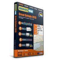
Memory Map Explorer 1:25, 000 Ordnance Survey Map 2015 - Sale: The Memory Map Explorer is the best possible outdoor map for harder walks and off-road riding. It transforms your PC/devices into the ultimate GPS system and it shows footpaths, bridleways and other rights of way along with thousands of points of interest! The 1:25, 000 map is an intuitive and easy-to-use software containing a complete 1:25, 000 scale Ordnance Survey Map of Great Britain. The best thing about this software is the features which comes with it. You can plan & manage your...

Save 10%! Hadrian\'s Wall, Roman Britain And The Scottish Borders: Travel through 2, 000 years of history as you visit ancient Roman sites such as Hadrian?s Wall, Dere Street, Birdoswald Fort, Steel Rigg and historic villages along the border of Scotland and England. You\'ll drive through stunning scenery in Northumberland National Park, the Irthing Valley and the Southern Uplands and learn about the Anglo-Scottish wars of the 14th?16th centuries. Your professional guide will illuminate the fascinating history of Roman Britain and the Scottish Borders on this...

Hadrian\'s Wall, Roman Britain And The Scottish Borders: Travel through 2, 000 years of history as you visit ancient Roman sites such as Hadrian?s Wall, Dere Street, Birdoswald Fort, Steel Rigg and historic villages along the border of Scotland and England. You\'ll drive through stunning scenery in Northumberland National Park, the Irthing Valley and the Southern Uplands and learn about the Anglo-Scottish wars of the 14th?16th centuries. Your professional guide will illuminate the fascinating history of Roman Britain and the Scottish Borders on this...

A Roam With A Roman: 2-hour Guided Walking Tour Of Hadrian\'s Wall: Explore the hidden gems and iconic sites of beautiful Northumberland on this 2-hour guided walking tour. Learn about the rise and fall of one of Rome?s most famous constructions at the UNESCO World Heritage Site of Hadrian?s Wall. Discover why Northumberland has more castles than any other county in England. See romantic moorland, sweeping coastlines and medieval villages. This tour brings the places you visit to life, by telling you the secrets tales and anecdotes that archaeologists usually...

Rosslyn Chapel And Hadrian\'s Wall Small Group Day Tour From Edinburgh: Join this small group tour (maximum 16 passengers) and travel to the amazing and mysterious 15th century Rosslyn Chapel, across the historic Scotland/England border and south to Hadrian?s Wall, a World Heritage Site celebrating the power ? and northern limit ? of the Roman Empire. Other highlights on this tour include the mighty Abbeys of Melrose and Jedburgh as you journey at a relaxed pace through the beautiful Borderlands.

5-day Tour From Edinburgh: York, Yorkshire Dales, Lake District And Hadrian\'s Wall: Discover some of northern England?s most picturesque regions on this 5-day excursion from Edinburgh. With an expert driver-guide, enjoy a scenic journey along the magnificent East Lothian coastline to the historical city of York. From here, visit the breathtaking natural beauty of North York Moors National Park and the Yorkshire Dales, and then relocate to the charming market town of Keswick to explore the Lake District and Hadrian?s Wall. Numbers limited to 16 on this small-group tour,...