Choose Which Site You Want To See


Explorer South Pennines Map: This OS Explorer South Pennines Map is map sheet OL21 and covers the Pennines including Todmorden, Hebdem Bridge and Burnley

Explorer Ol 21 South Pennines Map: Discover the beauty of the South Pennines with the Explorer OL21, a detailed map from Ordnance Survey which allows you to explore the Pennines in all its glory. This essential map covers Burnley, Hebdem Bridge, Todmorden and Keighley.
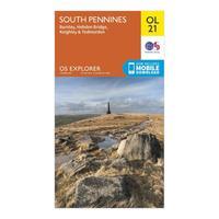
Ordnance Survey Explorer Ol 21 South Pennines Map, Orange: Discover the beauty of the South Pennines with the Explorer OL21, a detailed map from Ordnance Survey which allows you to explore the Pennines in all its glory. This essential map covers Burnley, Hebdem Bridge, Todmorden and Keighley. Colour Swatch:OrangeBrand:ORDNANCE SURVEYColour:Orange
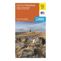
Ordnance Survey Explorer Ol 21 South Pennines Map, Orange: Discover the beauty of the South Pennines with the Explorer OL21, a detailed map from Ordnance Survey which allows you to explore the Pennines in all its glory. This essential map covers Burnley, Hebdem Bridge, Todmorden and Keighley. Colour Swatch:OrangeBrand:ORDNANCE SURVEYColour:Orange

South Pennines - Os Explorer Map Sheet Number Ol21: Purchase the South Pennines folded map: double-sided (boarded cover) from the OS Explorer Map range

South Pennines - Os Explorer Active Map Sheet Number Ol21: Purchase the South Pennines folded map: double-sided (boarded cover) from the OS Explorer Map range

Pathfinder South Pennines Walks Guide, Assorted: Seasoned experts lead you through the beauty and majesty of the South Pennines. Each of the 28 routes in this Guide is circular and graded with a variety of options depending on your ability. With clear, large-scale Ordnance Survey maps, GPS waypoints, parking areas and recommended places to eat, you\'ll be armed with a plethora of knowledge when heading out. Colour Swatch:AssortedWalking Accessory Type:BookAdditional Notes:With the Pathfinder South Pennines Walks Guide you¿ll discover a whole...

Pathfinder South Pennines Walks Guide, Assorted: Seasoned experts lead you through the beauty and majesty of the South Pennines. Each of the 28 routes in this Guide is circular and graded with a variety of options depending on your ability. With clear, large-scale Ordnance Survey maps, GPS waypoints, parking areas and recommended places to eat, you\'ll be armed with a plethora of knowledge when heading out. Colour Swatch:AssortedWalking Accessory Type:BookAdditional Notes:With the Pathfinder South Pennines Walks Guide you¿ll discover a whole...

Explorer Ol 20 South Devon Map: Take in the southern part of Dartmoor National Park and the southern region of Devon with the Explorer OL 20 Map from Ordnance Survey, a detailed guide to this spectacular area. The west side covers Plymouth, Ivybridge and the pleasant village of Newton Ferrers on the River Yealm esturary while the east side takes in Torquay, Dartmouth and Brixham.
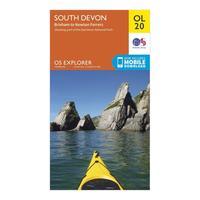
Ordnance Survey Explorer Ol 20 South Devon Map, Orange: Take in the southern part of Dartmoor National Park and the southern region of Devon with the Explorer OL 20 Map from Ordnance Survey, a detailed guide to this spectacular area. The west side covers Plymouth, Ivybridge and the pleasant village of Newton Ferrers on the River Yealm esturary while the east side takes in Torquay, Dartmouth and Brixham. Colour Swatch:OrangeBrand:ORDNANCE SURVEYColour:Orange
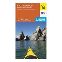
Ordnance Survey Explorer Ol 20 South Devon Map, Orange: Take in the southern part of Dartmoor National Park and the southern region of Devon with the Explorer OL 20 Map from Ordnance Survey, a detailed guide to this spectacular area. The west side covers Plymouth, Ivybridge and the pleasant village of Newton Ferrers on the River Yealm esturary while the east side takes in Torquay, Dartmouth and Brixham. Colour Swatch:OrangeBrand:ORDNANCE SURVEYColour:Orange

South Pennines Walks Guide: Some of the most experienced walkers have recommended the 28 graded, circular routes in this Pathfinder South Pennines Walks Guide. Walk through the stunning countryside and dales in an area that was once the most industrial part of Britain.
Ordnance Survey Explorer 272 Lincoln Map, Orange: Find all the best walks, routes, landmarks, points of interest and some terrific scenic drives with the 1:25000 scale Ordnance Survey Explorer 272 Lincoln Map. The 1:25000 scale Ordnance Survey Explorer 272 Lincoln Map will give you all the information you need to make any visit to the beautiful countryside around this area really special. With its 4cm to 1km (2 1/2 inches to 1 mile) scale, the OS Explorer Map series has been adopted by many individuals and organisations involved in outdoor...
Ordnance Survey Explorer 227 Peterborough Map, Assorted: Find all the best walks, routes, landmarks, points of interest and some terrific scenic drives with the 1:25000 scale Ordnance Survey Explorer 227 Peterborough Map. The 1:25000 scale Ordnance Survey Explorer 227 Peterborough Map will give you all the information you need to make any visit to the beautiful countryside around this area really special. With its 4cm to 1km (2 1/2 inches to 1 mile) scale, the OS Explorer Map series has been adopted by many individuals and organisations involved in...
Ordnance Survey Explorer 227 Peterborough Map, Assorted: Find all the best walks, routes, landmarks, points of interest and some terrific scenic drives with the 1:25000 scale Ordnance Survey Explorer 227 Peterborough Map. The 1:25000 scale Ordnance Survey Explorer 227 Peterborough Map will give you all the information you need to make any visit to the beautiful countryside around this area really special. With its 4cm to 1km (2 1/2 inches to 1 mile) scale, the OS Explorer Map series has been adopted by many individuals and organisations involved in...
Ordnance Survey Explorer 272 Lincoln Map, Orange: Find all the best walks, routes, landmarks, points of interest and some terrific scenic drives with the 1:25000 scale Ordnance Survey Explorer 272 Lincoln Map. The 1:25000 scale Ordnance Survey Explorer 272 Lincoln Map will give you all the information you need to make any visit to the beautiful countryside around this area really special. With its 4cm to 1km (2 1/2 inches to 1 mile) scale, the OS Explorer Map series has been adopted by many individuals and organisations involved in outdoor...

Ordnance Survey Explorer 427 Peterhead Map Book - Colour: 427: Explorer 427 Peterhead Map Book

Explorer 272 Lincoln Map: Find all the best walks, routes, landmarks, points of interest and some terrific scenic drives with the 1:25000 scale Ordnance Survey Explorer 272 Lincoln Map.

Explorer 227 Peterborough Map: Find all the best walks, routes, landmarks, points of interest and some terrific scenic drives with the 1:25000 scale Ordnance Survey Explorer 227 Peterborough Map.

Explorer Ol 21 Active D South Pennies Map: Map sheet number OL 21 in the detailed OS Explorer weatherproof Map series covers a beautiful area of the Pennines and includes Burnley, Hebdem Bridge, Todmorden and Keighley. Designed to help you to navigate in all weathers, the OL 21 Map gives you the tools to discover this areas highest peak, Lad Law at 517m, and shows the many footpaths which criss-cross the landscape.